Monday, 2 April 2018

Walk Three - Wolston, Bretford and Brandon

This walks starts in the village of Wolston and incorporates a short section of "A Coventry Way" (ACW), more about that later. It is approx 4 miles and I did it for the first time in March 2018.


From Wolston you follow ACW path past The Priory and under the railway bridge to Marston Hall Farm. You then follow the River Avon to the road to Bretford. At Bretford, you take the left hand path (not ACW) past the trig point from Walk one. Rather than follow that path all the way back to the stadium, head south to the bend in the A428. There is a short walk along the A428 before heading across a field to Brandon. Head towards the Royal Oak where you pick up the Centenary Way back to Wolston.

Photos from March 2018

The Priory

The Railway Bridge

Towards the River Avon from Marston Hall Farm

Marston Hall Farm

Looking south towards Brandon Grange Farm

Two bridges over the River Avon

It was a very misty day for the April walk ...

The River Avon

The trig point to the right
Photos from the May walk show some crops coming through:
Towards Brandon Grange Farm

That trig point again

Walk Two - Coombe #1

The walk is probably the least exciting of the walks as it has the most road walking. However, its main advantage is that I can do it from my front door, so no driving. It is approx 4 miles and my first time doing the walk for this blog was in March 2018 when there was snow on the ground. I also did the same walk a few days later after more snowfall.


I pick up the B4428 and walk as far as Coombe Abbey before turning south onto the Centenary Way (this particular section is known as Twelve O'clock Ride locally) through New Close Wood. You can either cut the corner and take the right hand path through the wood or carry on to go closer to the stadium. You then take the A428 back towards Coventry.

Photos from March 2018

Snow on Twelve O'Clock Ride

Across the fields from Twelve O'Clock Ride
A few days later - more snow
More snow across the fields

The April walk was drizzly rather than snowy!

New Close Wood
For the May walk it was still quite wet but at least we are seeing signs of Spring now.

New Close Wood

Stream in New Close Wood

Entrance to Coombe Abbey

Monday, 19 March 2018

Walk One - Bretford


This walk starts just off the A428 in a layby near the speedway stadium and is approx. 4 miles. I first did it in Feb 2018. That day it was incredibly muddy although the day was bright.

The walk starts along a bridleway at the back of the stadium before opening out into fields. As you start to enter Bretford one of the final fields has a trig point in the middle of it! Once in Bretford you briefly pick up the Coventry Way path before turning left near the antenna. Again you walk through open fields heading towards the edge Birchley Wood, skirting the wood to go past Merton Hall Farm and back to the start.

Photos from Feb 2018

Open fields and a bright day

Mud

You can spot the trig point in the middle of the field

Yep - definitely muddy!

Here are some photos from my April 2018 Bretford walk. It was still very wet and muddy, I decided to wear wellies for this walk and I'm glad I did. The corner of one field was under a good 9 inches of water.

Path through the trees

That antenna again!

Fields still very muddy
Trig point to left of tree

Cottage Farm

We have seen some much better weather in May. It's nice to see the crops starting to grow.

Compare to the first photo from February

Bluebells

Field of Rapeseed looking towards Birchley Farm

Morning Walks

I am lucky that I have been able to change my hours at work, meaning that I now have one morning off a week. I have decided that these mornings will be just for me, no doing little jobs etc. To ensure this, I am going out for walks. I have come up with five routes within a couple of miles from my house. One of which I can do from the front door. Every month, I will do at least four of the walks.

I hope to be able to chart the changing seasons by taking lots of photos of the walks. Over the next few days I will do separate posts for each walk. I hope you enjoy them.

Thursday, 27 August 2015

Kinder Scout - we did it!


I was born and raised in Manchester and as a child my Dad would take me walking in the hills above Glossop when we were visiting my Gran. I’m pretty sure it must have been on one of those walks that Dad told me about the Kinder Trespass, it’s certainly one of those things I’ve just always known about.


While I was off sick, I was looking around for podcasts to listen to and I came across Clare Balding’s Ramblings radio programme. I listened to about five years’ worth of podcasts, including one from Kinder Scout commemorating the 80th anniversary of the Trespass. It occurred to me then that despite having grown up not that far away, walked in the area as a child and walked in the area as an adult, I’d never done Kinder Scout. So that was it, I was going to do Kinder as a sort of catharsis, a way of telling cancer to take a running jump.


Now I’ve always been a bit of an organiser, so despite still having chemo I started planning. Usually with walks I follow a guide of some description so I did a bit of googling. I didn’t really find what I was looking for in terms of a guided walk but I did find Dean Read’s Peak Routes YouTube channel. Dean’s videos of his walks in the Peak District gave me some ideas for the route to take and also kept me going – it was fun to spot places in the videos that I had walked.

So, as described in previous posts on this blog, I did some training once the treatment was over. Then yesterday (Wednesday 26th August 2015) we, my husband, 11 year old son and I, did Kinder Scout, almost a year to the day since my diagnosis.


We stayed at the Youth Hostel in Castleton on both the Tuesday and Wednesday nights so we could have a full day to do the walk.  We’re not early risers but we were on the road to Edale before 10am although we were slowed down by an unexpected flock of sheep! (Note the weather.)


It was raining when we parked up at Edale so we all put on our waterproofs before walking along the main road up to the Nag’s Head pub and the official start of the Pennine Way. As advised by Dean and my boss and mentioned in the previous blog post, I decided not to follow the Pennine Way at this point but to go via Grindsbrook. By the time we’d left the road and joined the path to Grindsbrook the sun had come out, so off came the waterproofs. Note my yellow waterproof rucksack cover ...


We continued to follow Grindsbrook, climbing Grindsbrook Clough which involved a lot of scrambling over large boulders which we all enjoyed, especially my son.


We weren’t in any hurry and it took us two hours to get to the top of Grindsbrook Clough but it was worth it for the view.


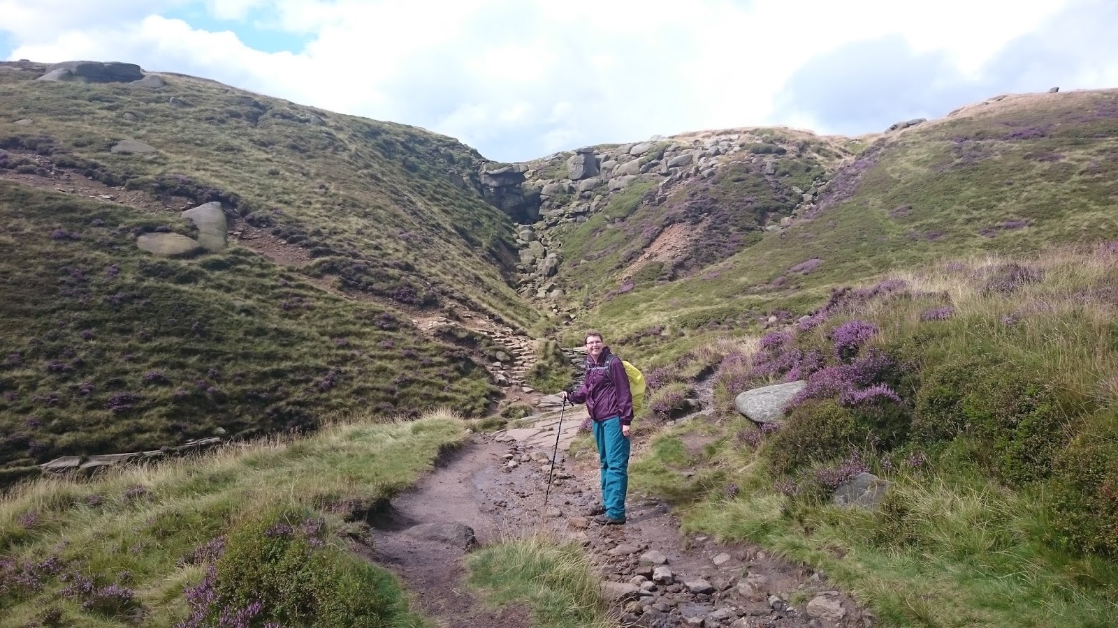
According to the OS map the path continued west for a short while before heading north for Kinder Downfall. However, we ended up going too far west and had to double back. Here’s where we should have turned but we carried on, stopped for lunch, carried on a bit further and then realised our mistake and headed back! Note, still got the rucksack cover ...


Once on the right path we discovered that actually there wasn’t much of a path at all! I’d taken a compass bearing at the top of Grindsbrook Clough and I was pleased I had. I’d also stored the Kinder Downfall geocache into my phone as a backup. We knew we had to basically follow the water but occasionally we veered off course. 

There was the odd amusing incident involving the peat bog, my son managed to leave his boot behind when trying to leap over once particularly boggy bit. We should have taken a picture of that! 

Eventually the path alongside the water became more obvious and we followed that. We knew we were heading in the right direction and it was nice to see Kinder Gates and know we were definitely on the right path! Soon afterwards we made it to Kinder Downfall. 


This view looks out from Kinder Downfall to Kinder Reservoir.


We spent a good half hour at Kinder Downfall enjoying the views and taking a breather. I tried to find the geocache but didn’t manage to spot it on this occasion. Once the break was over we then followed the Pennine Way path south. It was nice to see the trig point at Kinder Low and know we hadn’t much further to go. It was while we stopped for a quick drink at Kinder Low I realised my rucksack cover must have blown off in the wind!


However, those who know the area know that we still had Jacob’s Ladder to go. While fairly short in distance this part of the path is very steep and descending is pretty hard on the legs after walking all day. This photo doesn’t really do it justice.


Once down Jacob’s Ladder we continued to follow the Pennine Way path back to Edale and a well-deserved meal at the aptly named Rambler Inn. We reckon we did about 12 miles in total. That’s the furthest my son has ever walked, I’m really proud of him. It was a fantastic walk, tough in places but worth it for the great views.