In November 2019, I found out that the cancer had returned and spread to my liver and bones. I started making plans for trips I'd always wanted to do. I needed to do them before it was too late. Then, well we all know what happened, everything got put on hold. Two and a half years later, I am making plans again. More soon ...
Monday, 25 April 2022

Monday, 11 June 2018
Summer Walks
We are finally getting some decent weather and the stresses of daily life have eased. Consequently, I am hoping to go on more walks with a walking group to which I belong. This will mean I will probably do less of my "regular" routes. As the walking group walks are organised by various people I won't always give accurate route maps.
One walk I did with my husband over the Spring Bank Holiday was from Youlgreave in the Peak District.

One walk I did with my husband over the Spring Bank Holiday was from Youlgreave in the Peak District.

From Youlgreave we followed the Limestone Way until just before Elton where we left it to cross to Elton. From Elton we took the path to Dale End, across to Lowfields Farm, then north to re-join the Limestone Way by the river heading back to Youlgreave. This was about 7.5 miles.
 |
| Looking back towards Youlgreave |
 |
| From the top of Robin Hood's Stride |
 |
| Looking back towards Robin Hood's Stride from Elton |
 |
| The river path heading back towards Youlgreave |
 |
| Cooling off! |
Thursday, 17 May 2018
The Sowe Valley Footpath
Over the May bank holiday weekend, my son and I completed the Sowe Valley Footpath. We did it over two days as we incorporated associated walks so that we could do it from our house.
On Day One we walked from our house and joined the Binley circle (pink) and then the Willenhall circle (lilac) to get to the official start of the path. We then walked along the path to just before the Binley Road (Ullswater Rd) when we left the path to walk home. That was 8.5 miles.
On Day Two we walked from home to where we had left the path the day before and followed the path to the end at Hawkesbury Junction and the Greyhound Inn. This was 9 miles.
Despite the walk being through urban areas for the most part there is an amazing amount of nature areas to be found. It was lovely to see a different side of Coventry. On one part of the path near the hospital we saw a kestrel (we think) and we saw a number of nesting birds.
 |
| Day One |
 |
| Day Two |
On Day Two we walked from home to where we had left the path the day before and followed the path to the end at Hawkesbury Junction and the Greyhound Inn. This was 9 miles.
Despite the walk being through urban areas for the most part there is an amazing amount of nature areas to be found. It was lovely to see a different side of Coventry. On one part of the path near the hospital we saw a kestrel (we think) and we saw a number of nesting birds.
 |
| Swan and coot |
Saturday, 7 April 2018
A Coventry Way
Over three days of the 2018 Easter weekend I walked "A Coventry Way" a 40 mile circular route around Coventry. This was the first time I have completed a distance path and the first time I've done 10+ miles a day over consecutive days.
Day one Bretford to Corley 14.5 miles.
Day two Corley to Kenilworth 12.5 miles.
Day three Kenilworth to Bretford 13 miles plus a few diversions due to flooded paths.
Day two Corley to Kenilworth 12.5 miles.
Day three Kenilworth to Bretford 13 miles plus a few diversions due to flooded paths.
Information regarding the route can be found here.
We have had an awful lot of rain and a lot of the ground was very wet and muddy. In two places the path was completely impassable. However, it was a great walk to do and a real achievement. Easter Sunday marked three years since I returned to work.
 |
| Brinklow Castle mound |
 |
| Coventry's Ricoh Arena in the distance |
 |
| Muddy trousers at the end of day one |
 |
| Stoneleigh Church |
 |
| Stoneleigh Park - first part of the path that was impassable |
 |
| Stoneleigh Park - when I managed to get to the other side (via the road) |
 |
| Bubbenhall Church |
 |
| The River Avon between Ryton and Wolston - also impassable - another diversion via the road required! |
The Sowe Valley Footpath
This footpath follows the River Sowe in Coventry from Hawksbury Junction to Whitley.
You won't find this marked on an OS map but a leaflet is available in pdf form from here.
I haven't walked the entire footpath as yet which is about 12 miles but I have walked sections as circular routes from where I live.
One walk circular walk I did in March 2018 is known as the Walsgrave-Caludon Circle.
Once you add on the distance from my house this was about 6 miles.
Two points of interest are the remains of the 14th Century Caludon Castle and the church of St Mary Magdalene which is the oldest parish church in Coventry. I was very lucky with the weather.
You won't find this marked on an OS map but a leaflet is available in pdf form from here.
I haven't walked the entire footpath as yet which is about 12 miles but I have walked sections as circular routes from where I live.
One walk circular walk I did in March 2018 is known as the Walsgrave-Caludon Circle.
 |
| Walsgrave-Caludon Circle follows the brown route |
Once you add on the distance from my house this was about 6 miles.
Two points of interest are the remains of the 14th Century Caludon Castle and the church of St Mary Magdalene which is the oldest parish church in Coventry. I was very lucky with the weather.
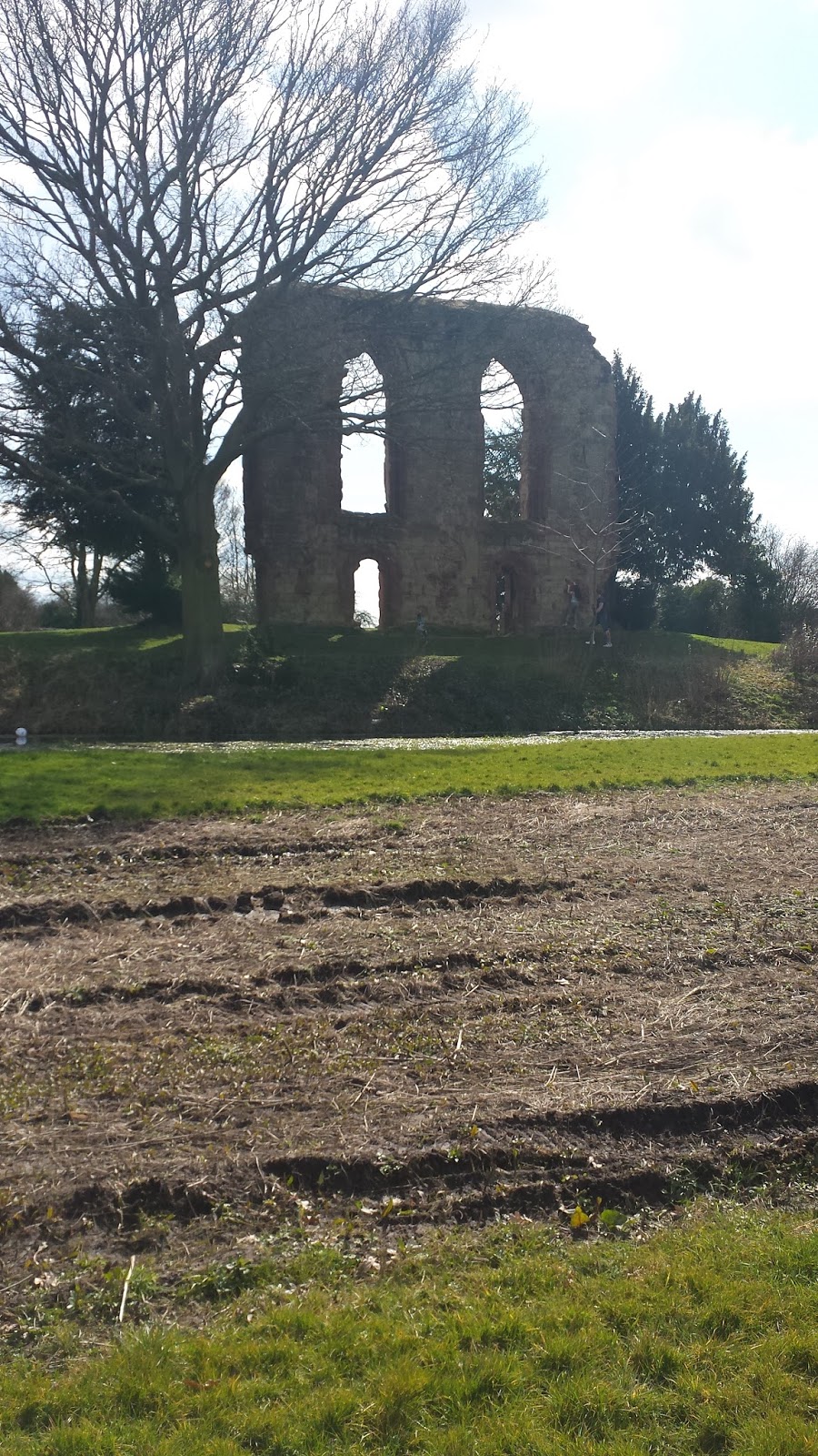 |
| Remains of Caludon Castle |
 |
| More info on the castle |
 |
| St Mary Magdalene's |
 |
| St Mary Magdalene's |
Tuesday, 3 April 2018
Walk Five - To Brinklow
This is a slightly longer walk, approx 5 miles. Again starting at the lay-by next to the stadium.

Retrace the steps of walk four skirting Birchley Wood and past Birchley Farm. Take the path to the right past Brinklow Quarry and on towards Brinklow until reaching Heath Lane. Here turn right along the lane where it eventually becomes a bridle path (ignoring the ACW path). You come to a point where you have to turn right. Shortly afterwards turn left and then right again to head back towards the stadium.
The weather has still been rubbish with lots of rain but the April 2018 walk did at least show signs of spring:
On another walk I did with my son that covered some of this walk, my son spotted an old car. We couldn't work out how it got there as the path is a bridleway.

Retrace the steps of walk four skirting Birchley Wood and past Birchley Farm. Take the path to the right past Brinklow Quarry and on towards Brinklow until reaching Heath Lane. Here turn right along the lane where it eventually becomes a bridle path (ignoring the ACW path). You come to a point where you have to turn right. Shortly afterwards turn left and then right again to head back towards the stadium.
 |
| Taken from Brinklow. The antenna can be seen in the distance |
 |
| Cottage Farm. To the left of the picture you can just make out the tower of St John the Baptist Church, Brinklow |
 |
| Towards Birchley Farm |
 |
| Bluebells |
 |
Walk Four - Coombe #2
This walk also starts from the lay-by next to the stadium and also incorporates Twelve O'Clock Ride. It is approx 4 miles and I first did this in March 2018.

From the lay-by walk north along the Twelve O'Clock Ride to the entrance to Coombe Abbey. Turn right along the B4428 before turning left onto Coombe Fields Rd. After about 500m take a path on the right across a field heading back towards the B4428. This field was incredibly muddy when I did this in March. Once at the B4428 cross the road picking up the path on the opposite side heading towards Birchley Farm. You stay on this path skirting Birchley Wood back to the lay-by.

From the lay-by walk north along the Twelve O'Clock Ride to the entrance to Coombe Abbey. Turn right along the B4428 before turning left onto Coombe Fields Rd. After about 500m take a path on the right across a field heading back towards the B4428. This field was incredibly muddy when I did this in March. Once at the B4428 cross the road picking up the path on the opposite side heading towards Birchley Farm. You stay on this path skirting Birchley Wood back to the lay-by.
 |
| Daffodils at the entrance to Coombe Abbey |
 |
| Birchley Farm |
 |
| The path along Birchley Wood |
For the April walk, the weather had finally improved!
 |
| Towards Birchley Farm |
 |
| Twelve O'Clock Ride |
 |
| New Close Wood |
The May Coombe #2 walk was on a lovely sunny day. This photo is looking towards Birchley Wood from Merton Hall Farm.


Monday, 2 April 2018
Walk Three - Wolston, Bretford and Brandon
This walks starts in the village of Wolston and incorporates a short section of "A Coventry Way" (ACW), more about that later. It is approx 4 miles and I did it for the first time in March 2018.

From Wolston you follow ACW path past The Priory and under the railway bridge to Marston Hall Farm. You then follow the River Avon to the road to Bretford. At Bretford, you take the left hand path (not ACW) past the trig point from Walk one. Rather than follow that path all the way back to the stadium, head south to the bend in the A428. There is a short walk along the A428 before heading across a field to Brandon. Head towards the Royal Oak where you pick up the Centenary Way back to Wolston.
Photos from March 2018
It was a very misty day for the April walk ...
Photos from the May walk show some crops coming through:

From Wolston you follow ACW path past The Priory and under the railway bridge to Marston Hall Farm. You then follow the River Avon to the road to Bretford. At Bretford, you take the left hand path (not ACW) past the trig point from Walk one. Rather than follow that path all the way back to the stadium, head south to the bend in the A428. There is a short walk along the A428 before heading across a field to Brandon. Head towards the Royal Oak where you pick up the Centenary Way back to Wolston.
Photos from March 2018
 |
| The Priory |
 |
| The Railway Bridge |
 |
| Towards the River Avon from Marston Hall Farm |
 |
| Marston Hall Farm |
 |
| Looking south towards Brandon Grange Farm |
 |
| Two bridges over the River Avon |
It was a very misty day for the April walk ...
 |
| The River Avon |
 |
| The trig point to the right |
 |
| Towards Brandon Grange Farm |
 |
| That trig point again |
Walk Two - Coombe #1

I pick up the B4428 and walk as far as Coombe Abbey before turning south onto the Centenary Way (this particular section is known as Twelve O'clock Ride locally) through New Close Wood. You can either cut the corner and take the right hand path through the wood or carry on to go closer to the stadium. You then take the A428 back towards Coventry.
Photos from March 2018
 |
| Snow on Twelve O'Clock Ride |
 |
| Across the fields from Twelve O'Clock Ride |
 |
| A few days later - more snow |
 |
| More snow across the fields |
The April walk was drizzly rather than snowy!
 |
| New Close Wood |
 |
| New Close Wood |
 |
| Stream in New Close Wood |
 |
| Entrance to Coombe Abbey |
Subscribe to:
Posts (Atom)